FX.co ★ Five most dangerous fault lines in Earth's crust
Five most dangerous fault lines in Earth's crust
San Andreas Fault (California, US)
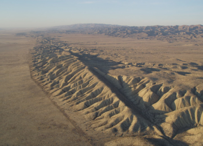
One of the largest and most dangerous faults on the planet is the San Andreas Fault, located along the boundary between the Pacific and North American lithospheric plates. In 1895, Professor Andrew Lawson from the University of California, Berkeley, first studied this fault and named it after the San Andreas Valley. Lawson researched the fault from 1895 to 1908. In 1906, a massive earthquake with a magnitude of 7.7 hit San Francisco, which Lawson attributed to the possible extension of the fault into southern California. The San Andreas Fault currently stretches over 1,200 km and is responsible for powerful earthquakes in the region, such as the 1989 Loma Prieta quake with a magnitude of 7.1. The most earthquake-prone area today is near Los Angeles.
Pacific Ring of Fire
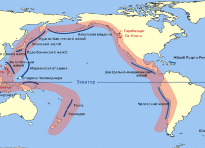
The Pacific Ring of Fire is another dangerous area. It includes 328 of the planet's 540 active volcanoes. This zone extends along the Pacific Ocean's perimeter. On the western side, it runs from the Kamchatka Peninsula through the Kuril, Japanese, and Philippine Islands, New Guinea, the Solomon Islands, and New Zealand, all the way to Antarctica. The eastern part includes volcanoes in Northeast Antarctica, Tierra del Fuego, the Andes, the Cordilleras, and the Aleutian Islands. One of the most dangerous sections of the Ring of Fire is in Indonesia, where the Indian Ocean plate is gradually sliding beneath the Pacific plate. This combination leads to frequent volcanic eruptions, tsunamis, and earthquakes.
Lake Kivu (Rwanda and Democratic Republic of Congo)
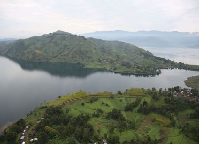
Lake Kivu, one of the Great African Lakes, is a freshwater body located in the East African Rift Valley. This unique geological formation lies at the boundary of the African and Arabian tectonic plates. Lake Kivu separates Rwanda and the Democratic Republic of Congo, with one of the world's largest freshwater islands, Idjwi, situated on the Congolese side. The lake's basin is gradually expanding, causing both deepening waters and volcanic activity in the region. In 1948, the Kituro volcano erupted nearby. Scientists believe that the real danger comes not from the lake itself but from the methane and carbon dioxide deposits at its bottom, which could explode and potentially kill 2 million people living in the area. A volcanic eruption could trigger such a disaster. In 2017, the Nyiragongo volcano erupted in the region, fortunately without fatalities. However, a similar event in 2021 resulted in the deaths of 30 people.
Baikal Rift (Russia)
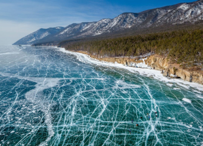
Lake Baikal, considered one of the most unique natural formations, is on the UNESCO World Heritage list. The Baikal Rift Zone, a deep crustal fault stretching 1,500 km, is especially noteworthy. The central part of the rift is filled with water. Geologists believe this rift is a result of the divergence between the Eurasian and Amur tectonic plates, with the latter slowly moving toward Japan and colliding with the North American and Philippine plates, contributing to seismic activity in Japan. The primary danger lies at the bottom of Lake Baikal, which is itself a tectonic fault. Scientists predict that in several hundred million years, Baikal could transform into an ocean. However, even now, the region experiences regular, though mild, earthquakes, which occasionally cause parts of the land, and sometimes homes, to sink.
Suswa Rift (Kenya, Africa)
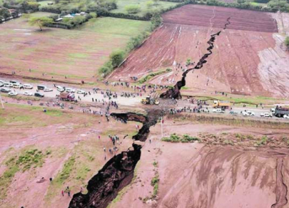
The Suswa Rift in Kenya, discovered in 2018, closes the top five. Despite its small size, it alarms both local residents and geological experts. According to scientists, the Suswa Rift could potentially split the continent into two. This geological formation is named after the nearby Suswa volcano. It lies at the boundary between the African and Arabian tectonic plates, and the situation in the region has been increasingly unstable, with frequent underground volcanic eruptions. Geologists predict that if the crack continues to expand, it could divide Africa in 50 million years. A similar rift, as some experts believe, caused the separation of Africa from South America over 135 million years ago. Currently, the Suswa Rift creates many problems for the locals, including the potential collapse of a major road that runs through the fault.
