FX.co ★ Main maritime trade routes: economic value and development prospects


Main maritime trade routes: economic value and development prospects
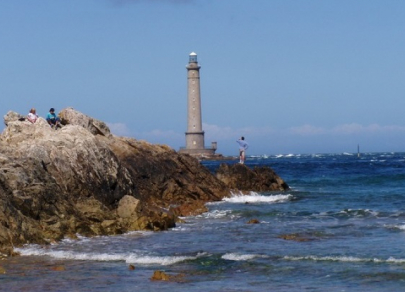
English Channel
The English Channel is a key European trade route. It divides the UK and France and connects the North Sea with the Atlantic Ocean which makes it the world's busiest channel. About 500 vessels pass the English Channel on a daily basis.
The English Channel’s length is 578 km, the width of its western part is 250 km, the eastern part is 32 km, and the fairway depth is slightly more than 23 m.
Strait of Malacca
The Strait of Malacca connects the Indian Ocean with the Pacific Ocean. The strait is located between the Malay Peninsula and Sumatra.
About 50 thousand vessels pass through this route on a yearly basis which is equal to 20-25% of the total sea turnover.
Transportation of coal, oil, LNG, palm oil, Indonesian coffee is carried out between the most densely populated countries of the world - India, Indonesia, and China.
The length of the strait is 957 km, the smallest width is 15 km, and the maximum depth is 12 m.
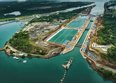
Panama Canal
The Panama Canal connects the Gulf of Panama with the Caribbean Sea and the Atlantic Ocean. The canal has significant geopolitical value. The artificial waterway provides one of the fastest links between San Francisco and New York. Therefore, there is no need to bypass South America. The distance has contracted twice from 22.5 thousand km to 9.5 thousand km.
Recently, new gates have been opened. It requires new standards for larger vessels.
The seaway canal has a length of 81.6 km, a width of 150 m, and a depth of 12 m. Moreover, it stretches to 65.2 km by land and 16.4 km by sea. The annual cargo flow is over 14 thousand vessels that ship vegetable oil, fats, chemicals, spare parts, and grains.
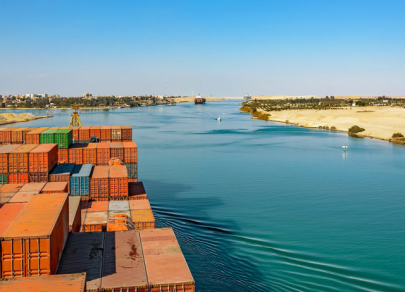
Suez Canal
The Suez Canal is a conventional border between Africa and Eurasia. It is the shortest waterway between the Indian Ocean and offshore of the Mediterranean Ocean. Thanks to the Suez Canal it became possible to transport oil from Asia to Europe without bypassing Africa and unloading ships and carriage of goods by land between offshore zones.
The Suez Canal accounts for about 20% of all transported oil and 10% of the world trade on a yearly basis. Egypt’s shipment profit by the canal is $5 billion. In the near future, it is planned to create new channels in order to take higher profit from the canal’s increased traffic. However, authorities in neighboring countries are thinking about building detours, as the price of a passage through the Suez Canal is quite high.
The total length of the Suez Canal reaches 193 km, the width on the water surface is 120-150 m, on the bottom - 45-60 m and the depth is approximately 13 m.
Strait of Hormuz
Despite its modest size, the Strait of Hormuz has strategic value for gas and oil transportation as it is the only maritime route that connects the Gulf of Oman with the Persian Gulf. Around 40% of all global sea export of oil and crude products falls on the waterway.
Hydrocarbons produced in the Persian Gulf countries are exported to third countries, such as Japan, the USA, and Western Europe.
The strait has a length of 195 km, the width at the narrowest point is 54 km, and the depth is 229 m.
Danish straits
The Danish Straits are a system that connects the harbors of the Baltic Sea and the World Oceans.
They are located between the Scandinavian and Jutland peninsulas, including the Skagerrak (110 km), Kattegat (60 km), Øresund (10.5 km), and Great and Little Belt (3.7 km and 0.5 km, respectively).
According to experts, over 3.2 million barrels of oil and crude products per day are transported through the straits annually.
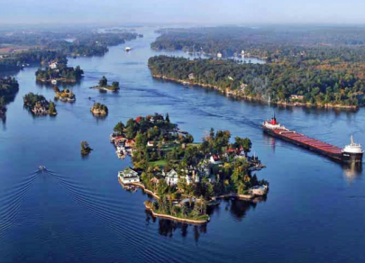
Saint Lawrence River
The Saint Lawrence River begins at the outflow of Lake Ontario and runs into the Gulf of Saint Lawrence, connecting the Great Lakes with the Atlantic Ocean. The maritime route is a system of locks, channels and canals. Being one of the tributaries of the Mississippi River, the Saint Lawrence River is navigable year-round. The route's freight turnover reaches 40 million tons.
There are more than 150 harbors along the waterway on the territory of the US and Canada, from the Atlantic Ocean to Lake Superior. The width of the river at the mouth reaches 130 km and the length is 1,197 km. The basin area is more than 1.344 million square km.
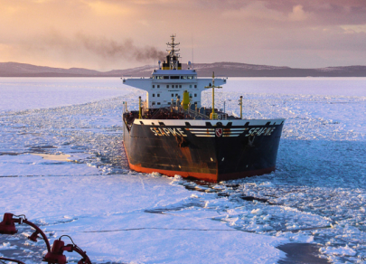
Northeast Passage
The Northeast Passage connects the European part of Russia with the Far East and stretches from the Kara Strait to Providence Bay for 5,600 km, reducing the shipment distance twice. The waterway passes through the seas of the Arctic Ocean and the Pacific Ocean serving harbors of the Arctic and large rivers of Siberia.
Severe weather conditions in the Arctic delay the development of the route. However, it is obvious that the Northeast Passage will become one of the most relevant waterways in the future. In 2018, the freight turnover (import of fuel, equipment, provisions, as well as the export of timber and natural resources) amounted to 18 million tonnes. In 2019, it can increase by more than 1.5 times, up to 30 million tonnes.
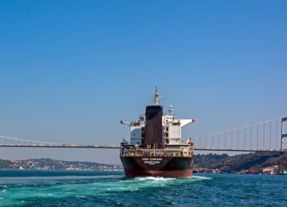
Bosporus
Despite the heavy traffic of transit vessels, ferries, and small vessels, a flow of up to 6 knots, and sharp changes in the weather in the autumn-winter period, the Bosporus is still one of the major waterways of the maritime freight traffic between Europe and the Anatolian peninsula.
About 50 thousand vessels transport oil and crude products along the route on a yearly basis. A lion’s share of all shipments is commercial and military trade.
Connecting the Black Sea with the Sea of Marmara, it has a length of about 30 km. The maximum width of the strait is observed in its northern part and is 3,700 m. The minimum width is 700 m. The waterway depth varies from 33 to 80 m.